Geolocate

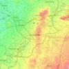
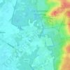
Onna topographic map

Click on the map to display elevation.

About this map

Name: Onna topographic map, elevation, terrain.

Location: Onna, Steenwijkerland, Overijssel, Netherlands (52.76466 6.13152 52.78411 6.17659)

Average elevation: 4 m

Minimum elevation: -4 m

Maximum elevation: 14 m

Other topographic maps

Click on a map to view its topography, its elevation and its terrain.
Lonneker

Netherlands > Overijssel > Enschede

Average elevation: 47 m

De Meele

Netherlands > Overijssel > Nieuwleusen

Average elevation: 2 m

Schoolbuurt

Netherlands > Overijssel > Markelo

Average elevation: 17 m

Lemelerberg

Netherlands > Overijssel > Lemele

Average elevation: 19 m

Enschede

Netherlands > Overijssel > Enschede

Average elevation: 34 m

Frankhuis

Netherlands > Overijssel > Zwolle

Average elevation: 3 m

Usselo

Netherlands > Overijssel > Enschede

Average elevation: 31 m

Zuurberg

Netherlands > Overijssel > Holten

Average elevation: 17 m

Tankenberg

Netherlands > Overijssel > de Lutte

Average elevation: 58 m

Witteberg

Netherlands > Overijssel

Average elevation: 57 m

Helhuizen

Netherlands > Overijssel > Holten

Average elevation: 20 m

Gear up for your next adventure:

🧊Insulated Cooler Bags - Keep food fresh for day trips to remote geographic sites
👄SPF Lip Balm - Prevent sun and wind-burnt lips on mountain ridges
🏫Topographic World Globes - 3D physical relief globes to understand global geography
📣High-Decibel Survival Whistles - Signaling tool for rescue that carries much further than a human voice
🛌Sleeping Mats - Insulated mats for camping comfort

As an Amazon Associate, this site earns from qualifying purchases at no extra cost to you.