Geolocate

Farmville topographic map

Click on the map to display elevation.

About this map
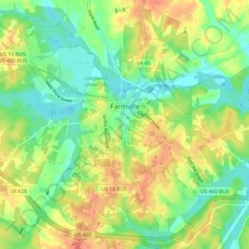
Name: Farmville topographic map, elevation, terrain.

Location: Farmville, Prince Edward County, Virginia, United States (37.26826 -78.44422 37.32712 -78.36304)

Average elevation: 113 m

Minimum elevation: 87 m

Maximum elevation: 149 m

Other topographic maps

Click on a map to view its topography, its elevation and its terrain.

Rice

United States > Virginia > Prince Edward County

Average elevation: 128 m

Gear up for your next adventure:

🥾Trail Running Shoes - Shoes for trail running
🔥Ferrocerium Rod Fire Starters - Reliable fire lighting in wet or windy conditions without matches
🛌Compact Down Sleeping Bags - Warmth without the bulk, ideal for backcountry camping
🧰Survival Kits - Essential survival gear
🎨Portable Watercolor Kits - Paint the landscapes and topographic views you discover

As an Amazon Associate, this site earns from qualifying purchases at no extra cost to you.