Geolocate

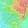
Pramadom topographic map

Click on the map to display elevation.

About this map

Name: Pramadom topographic map, elevation, terrain.

Location: Pramadom, Konni, Pathanamthitta, Kerala, 689646, India (9.22791 76.76943 9.26791 76.80943)

Average elevation: 34 m

Minimum elevation: 11 m

Maximum elevation: 116 m

Other topographic maps

Click on a map to view its topography, its elevation and its terrain.
Aruvappulam

India > Kerala > Konni

Average elevation: 519 m

Gurunathanmannu

India > Kerala > Konni

Average elevation: 724 m

Gear up for your next adventure:

🦘Outback Survival Gear - Essential gear for Australian outback
🧥Packable Rain Jackets - Breathable waterproof layers for unpredictable mountain weather
📻Handheld UHF Radios - Critical communication for groups in the Australian outback
🕶️Polarized Sunglasses - UV protection sunglasses for outdoors
🚁Camera Drones with GPS - Capture aerial views of the landscape to compare with topo maps

As an Amazon Associate, this site earns from qualifying purchases at no extra cost to you.