Geolocate

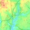
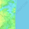
Oulton topographic map

Click on the map to display elevation.

About this map

Name: Oulton topographic map, elevation, terrain.

Location: Oulton, East Suffolk, Suffolk, England, United Kingdom (52.47385 1.68155 52.50546 1.73021)

Average elevation: 13 m

Minimum elevation: -2 m

Maximum elevation: 34 m

Other topographic maps

Click on a map to view its topography, its elevation and its terrain.
Hinton

United Kingdom > England > Suffolk > East Suffolk > Blythburgh

Average elevation: 19 m

Hulver Street

United Kingdom > England > Suffolk > East Suffolk

Average elevation: 16 m

Sibton Green

United Kingdom > England > Suffolk > East Suffolk

Average elevation: 35 m

Sweffling

United Kingdom > England > Suffolk > East Suffolk

Average elevation: 32 m

Thorpeness

United Kingdom > England > Suffolk > East Suffolk

Average elevation: 4 m

Eastbridge

United Kingdom > England > Suffolk > East Suffolk

Average elevation: 10 m

Benhall Green

United Kingdom > England > Suffolk > East Suffolk

Average elevation: 21 m

Henstead

United Kingdom > England > Suffolk > East Suffolk

Average elevation: 13 m

Somerleyton

United Kingdom > England > Suffolk > East Suffolk

Average elevation: 9 m

Butley Abbey

United Kingdom > England > Suffolk > East Suffolk > Butley

Average elevation: 9 m

Kelsale

United Kingdom > England > Suffolk > East Suffolk

Average elevation: 32 m

Wangford

United Kingdom > England > Suffolk > East Suffolk

Average elevation: 13 m

Wenhaston

United Kingdom > England > Suffolk > East Suffolk

Average elevation: 16 m

Thorpeness

United Kingdom > England > Suffolk > East Suffolk

Average elevation: 4 m

Wangford

United Kingdom > England > Suffolk > East Suffolk

Average elevation: 13 m

Sizewell

United Kingdom > England > Suffolk > East Suffolk > Leiston

Average elevation: 5 m

Sweffling

United Kingdom > England > Suffolk > East Suffolk

Average elevation: 32 m

Wangford

United Kingdom > England > Suffolk > East Suffolk

Average elevation: 13 m

Sizewell

United Kingdom > England > Suffolk > East Suffolk > Leiston

Average elevation: 5 m

Gear up for your next adventure:

⛺Ultralight Solo Tents - Compact shelters for multi-day topographic surveying expeditions
🚁Camera Drones with GPS - Capture aerial views of the landscape to compare with topo maps
👄SPF Lip Balm - Prevent sun and wind-burnt lips on mountain ridges
🦟Heavy Duty Insect Repellent - Essential protection against flies, mozzies, and march flies
🧯Animal Deterrent Spray - Safety spray for wildlife

As an Amazon Associate, this site earns from qualifying purchases at no extra cost to you.