
L'Adrienne topographic map
Interactive map
Click on the map to display elevation.
About this map
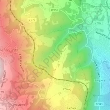
Name: L'Adrienne topographic map, elevation, terrain.
Average elevation: 642 m
Minimum elevation: 436 m
Maximum elevation: 859 m
Other topographic maps
Click on a map to view its topography, its elevation and its terrain.
Mas d'Argnat
France > Auvergne-Rhône-Alpes > Puy-de-Dôme > Argnat
Mas d'Argnat, Argnat, Sayat, Riom, Puy-de-Dôme, Auvergne-Rhône-Alpes, France métropolitaine, 63530, France
Average elevation: 677 m