
Capelle aan den IJssel topographic map
Interactive map
Click on the map to display elevation.
Capelle aan den IJssel
Dutch Topographic map of the municipality of Capelle aan den IJssel, June 2015.
About this map
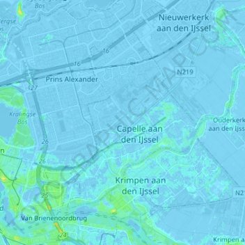
Name: Capelle aan den IJssel topographic map, elevation, terrain.
Average elevation: -1 m
Minimum elevation: -8 m
Maximum elevation: 15 m
Other topographic maps
Click on a map to view its topography, its elevation and its terrain.
Capelle aan den IJssel
Netherlands > South Holland > Capelle aan den IJssel
Dutch Topographic map of the municipality of Capelle aan den IJssel, June 2015.
Average elevation: -1 m