
Rogil topographic map
Interactive map
Click on the map to display elevation.
About this map
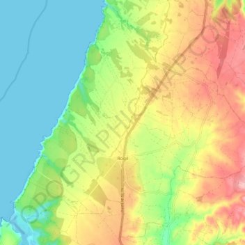
Name: Rogil topographic map, elevation, terrain.
Location: Rogil, Aljezur, Faro, 8670-440, Portugal (37.34277 -8.83963 37.41881 -8.74029)
Average elevation: 78 m
Minimum elevation: 0 m
Maximum elevation: 226 m
Other topographic maps
Click on a map to view its topography, its elevation and its terrain.