Geolocate

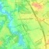
Erial topographic map

Click on the map to display elevation.

About this map

Name: Erial topographic map, elevation, terrain.

Location: Erial, Gloucester Township, Camden County, New Jersey, 08081, United States (39.75345 -75.02628 39.79345 -74.98628)

Average elevation: 45 m

Minimum elevation: 17 m

Maximum elevation: 66 m

Other topographic maps

Click on a map to view its topography, its elevation and its terrain.
Gear up for your next adventure:

🧦Merino Wool Hiking Socks - Moisture-wicking socks to prevent blisters during long topographic surveys
📦Crushproof Equipment Cases - Safe transport for sensitive surveying and mapping instruments
🔪Outdoor Multi-tools - Versatile tools for gear repair and survival tasks in the wilderness
💡Collapsible Camping Lanterns - Illuminate your base camp or tent for map studying at night
🌧️Rain Jackets - Waterproof jackets for hiking

As an Amazon Associate, this site earns from qualifying purchases at no extra cost to you.