
Kendari topographic map
Interactive map
Click on the map to display elevation.
About this map
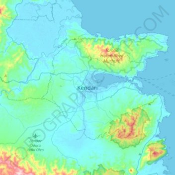
Name: Kendari topographic map, elevation, terrain.
Location: Kendari, Southeast Sulawesi, 93121, Indonesia (-4.15181 122.35801 -3.83181 122.67801)
Average elevation: 64 m
Minimum elevation: -3 m
Maximum elevation: 609 m