Geolocate

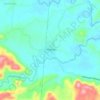
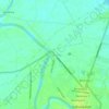
Hilamonan topographic map

Click on the map to display elevation.

About this map

Name: Hilamonan topographic map, elevation, terrain.

Location: Hilamonan, Kabankalan, Negros Occidental, Negros Island Region, Philippines (9.95171 122.80762 10.01848 122.91369)

Average elevation: 102 m

Minimum elevation: 3 m

Maximum elevation: 517 m

Other topographic maps

Click on a map to view its topography, its elevation and its terrain.
Bantayan

Philippines > Negros Occidental > Kabankalan > Bantayan

Average elevation: 196 m

Magballo

Philippines > Negros Occidental > Kabankalan > Magballo

Average elevation: 166 m

Camugao

Philippines > Negros Occidental > Kabankalan

Average elevation: 11 m

San Jose

Philippines > Negros Occidental > Kabankalan

Average elevation: 131 m

Tagukon

Philippines > Negros Occidental > Kabankalan

Average elevation: 129 m

Binicuil

Philippines > Negros Occidental > Kabankalan

Average elevation: 7 m

Camugao

Philippines > Negros Occidental > Kabankalan

Average elevation: 11 m

Tampalon

Philippines > Negros Occidental > Kabankalan

Average elevation: 150 m

Gear up for your next adventure:

👖Convertible Hiking Trousers - Zip-off legs to adapt to changing temperatures throughout the day
☀️Portable Solar Chargers - High-efficiency panels to hang on your backpack while walking
🔋Solar Power Banks - Charge your phone and GPS using the sun while deep in the bush
🥤Outdoor Water Bottles - Reusable bottles for outdoor activities
🌿Flora and Fauna Field Guides - Identify the plants and animals you encounter on your route

As an Amazon Associate, this site earns from qualifying purchases at no extra cost to you.