
Thank you for supporting this site ❤️
Make a donation
Make a donation
Gear up for your next adventure:
As an Amazon Associate, this site earns from qualifying purchases at no extra cost to you.
Dönje topographic map
Click on the map to display elevation.
Thank you for supporting this site ❤️
Make a donation
Make a donation
Gear up for your next adventure:
As an Amazon Associate, this site earns from qualifying purchases at no extra cost to you.
About this map
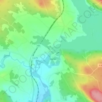
Name: Dönje topographic map, elevation, terrain.
Location: Dönje, Bollnäs kommun, Gävleborg County, 821 36, Sweden (61.37778 16.38288 61.41778 16.42288)
Average elevation: 97 m
Minimum elevation: 68 m
Maximum elevation: 165 m
Thank you for supporting this site ❤️
Make a donation
Make a donation
Gear up for your next adventure:
As an Amazon Associate, this site earns from qualifying purchases at no extra cost to you.