Geolocate

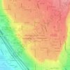
Elk Ridge topographic map

Click on the map to display elevation.

About this map
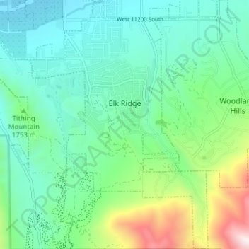
Name: Elk Ridge topographic map, elevation, terrain.

Location: Elk Ridge, Utah County, Utah, United States (39.98373 -111.70111 40.03084 -111.65627)

Average elevation: 1,698 m

Minimum elevation: 1,444 m

Maximum elevation: 2,483 m

Other topographic maps

Click on a map to view its topography, its elevation and its terrain.
Spanish Fork Peak

United States > Utah > Utah County

Average elevation: 2,720 m

Edgemont

United States > Utah > Utah County > Provo

Average elevation: 1,538 m

Lone Peak

United States > Utah > Utah County

Average elevation: 3,013 m

Mount Timpanogos

United States > Utah > Utah County

Average elevation: 3,139 m

Bald Mountain Overlook

United States > Utah > Utah County

Average elevation: 2,552 m

Curtis

United States > Utah > Utah County > Orem

Average elevation: 1,433 m

Mount Timpanogos

United States > Utah > Utah County

Average elevation: 3,139 m

Mount Timpanogos

United States > Utah > Utah County

Average elevation: 3,139 m

Mount Nebo

United States > Utah > Utah County

Average elevation: 3,115 m

Nutty Putty Cave

United States > Utah > Utah County

Average elevation: 1,547 m

Mount Timpanogos

United States > Utah > Utah County

Average elevation: 3,139 m

Caryhurst

United States > Utah > Utah County > Provo

Average elevation: 1,563 m

Lone Peak

United States > Utah > Utah County

Average elevation: 3,013 m

Curtis

United States > Utah > Utah County > Orem

Average elevation: 1,433 m

Birdseye

United States > Utah > Utah County

Average elevation: 1,780 m

Pleasant View

United States > Utah > Utah County > Provo

Average elevation: 1,446 m

Townsend

United States > Utah > Utah County > Genola

Average elevation: 1,438 m

Gear up for your next adventure:

🐍Snake Gaiters - Protection against snake bites
☀️Portable Solar Chargers - High-efficiency panels to hang on your backpack while walking
📱Tablet Tripod Mounts - Steady platforms for viewing digital maps or taking long exposures
🔥Windproof Plasma Lighters - USB rechargeable lighters that work in high-altitude winds
🧦Merino Wool Hiking Socks - Moisture-wicking socks to prevent blisters during long topographic surveys

As an Amazon Associate, this site earns from qualifying purchases at no extra cost to you.