
La Vanelle topographic map
Interactive map
Click on the map to display elevation.
About this map
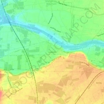
Name: La Vanelle topographic map, elevation, terrain.
Average elevation: 161 m
Minimum elevation: 130 m
Maximum elevation: 195 m
Other topographic maps
Click on a map to view its topography, its elevation and its terrain.
Chirons
France > Auvergne-Rhône-Alpes > Drôme > Châteauneuf-sur-Isère
Chirons, Châteauneuf-sur-Isère, Valence, Drôme, Auvergne-Rhône-Alpes, France métropolitaine, 26300, France
Average elevation: 175 m