
Sempala topographic map
Interactive map
Click on the map to display elevation.
About this map
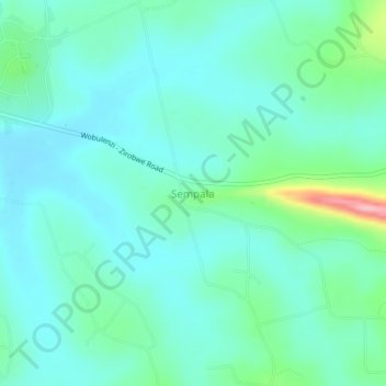
Name: Sempala topographic map, elevation, terrain.
Location: Sempala, Luweero, Central Region, Uganda (0.68671 32.53447 0.72671 32.57447)
Average elevation: 1,151 m
Minimum elevation: 1,120 m
Maximum elevation: 1,278 m
Other topographic maps
Click on a map to view its topography, its elevation and its terrain.