Geolocate

Aswan High Dam topographic map

Click on the map to display elevation.

About this map

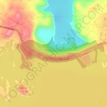
Name: Aswan High Dam topographic map, elevation, terrain.

Location: Aswan High Dam, Aswan, Egypt (23.96616 32.86465 23.97467 32.88885)

Average elevation: 169 m

Minimum elevation: 104 m

Maximum elevation: 209 m

Other topographic maps

Click on a map to view its topography, its elevation and its terrain.

Aswan

Egypt > Aswan

Average elevation: 184 m

Gear up for your next adventure:

📦Crushproof Equipment Cases - Safe transport for sensitive surveying and mapping instruments
🧤Hiking Gloves - Protective gloves for outdoor use
🧣Merino Neck Gaiters - Versatile headwear for warmth, sun protection, or dust filtering
🏫Topographic World Globes - 3D physical relief globes to understand global geography
🛰️Handheld GPS Units - Rugged GPS devices for tracking coordinates and elevation in the Australian bush

As an Amazon Associate, this site earns from qualifying purchases at no extra cost to you.