
La Batarelle topographic map
Interactive map
Click on the map to display elevation.
About this map
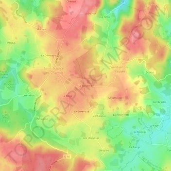
Name: La Batarelle topographic map, elevation, terrain.
Average elevation: 576 m
Minimum elevation: 521 m
Maximum elevation: 618 m
Other topographic maps
Click on a map to view its topography, its elevation and its terrain.
Saint-Avit-le-Pauvre
France > Nouvelle-Aquitaine > Creuse > Saint-Avit-le-Pauvre
Saint-Avit-le-Pauvre, Guéret, Creuse, Nouvelle-Aquitaine, France métropolitaine, 23480, France
Average elevation: 574 m