
兵团二二一团 topographic map
Interactive map
Click on the map to display elevation.
About this map
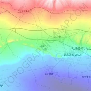
Name: 兵团二二一团 topographic map, elevation, terrain.
Location: 兵团二二一团, 高昌区, 吐鲁番市, 新疆维吾尔自治区, 中国 (42.76145 88.85963 43.20559 89.18743)
Average elevation: 270 m
Minimum elevation: -145 m
Maximum elevation: 1,360 m
Other topographic maps
Click on a map to view its topography, its elevation and its terrain.