
Sprinkange topographic map
Interactive map
Click on the map to display elevation.
About this map
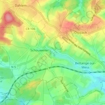
Name: Sprinkange topographic map, elevation, terrain.
Location: Sprinkange, Dippach, Canton Capellen, 4998, Luxembourg (49.55985 5.94497 49.59985 5.98497)
Average elevation: 342 m
Minimum elevation: 302 m
Maximum elevation: 399 m