
동남구 topographic map
Interactive map
Click on the map to display elevation.
About this map
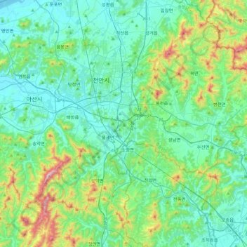
Name: 동남구 topographic map, elevation, terrain.
Location: 동남구, Cheonan, Chungcheong du Sud, Corée du Sud (36.62034 127.00936 36.89220 127.42042)
Average elevation: 133 m
Minimum elevation: 0 m
Maximum elevation: 670 m