Geolocate

Zellingen topographic map

Click on the map to display elevation.

About this map
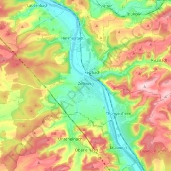
Name: Zellingen topographic map, elevation, terrain.

Location: Zellingen, Verwaltungsgemeinschaft Zellingen, Landkreis Main-Spessart, Bavaria, 97225, Germany (49.87028 9.69945 49.92407 9.85974)

Average elevation: 257 m

Minimum elevation: 158 m

Maximum elevation: 356 m

Other topographic maps

Click on a map to view its topography, its elevation and its terrain.

Mühlbach

Germany > Bavaria > Landkreis Main-Spessart > Karlstadt

Average elevation: 232 m

Gear up for your next adventure:

🦟Insect Repellent - Protection against insects
🔥Ferrocerium Rod Fire Starters - Reliable fire lighting in wet or windy conditions without matches
🧭Military Style Lensatic Compass - Durable sighting compasses for advanced land navigation and surveying
🧺Fast-Dry Microfiber Towels - Large towels that pack down to the size of an orange
🔋Rechargeable Batteries - Eco-friendly power for high-drain GPS units and flashlights

As an Amazon Associate, this site earns from qualifying purchases at no extra cost to you.