
Thank you for supporting this site ❤️
Make a donation
Make a donation
Gear up for your next adventure:
As an Amazon Associate, this site earns from qualifying purchases at no extra cost to you.
Cijengkol topographic map
Click on the map to display elevation.
Thank you for supporting this site ❤️
Make a donation
Make a donation
Gear up for your next adventure:
As an Amazon Associate, this site earns from qualifying purchases at no extra cost to you.
About this map
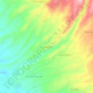
Name: Cijengkol topographic map, elevation, terrain.
Location: Cijengkol, Sukabumi, West Java, 43356, Indonesia (-6.89411 106.82279 -6.85411 106.86279)
Average elevation: 569 m
Minimum elevation: 472 m
Maximum elevation: 705 m
Thank you for supporting this site ❤️
Make a donation
Make a donation
Gear up for your next adventure:
As an Amazon Associate, this site earns from qualifying purchases at no extra cost to you.