
Ventspils topographic map
Interactive map
Click on the map to display elevation.
About this map
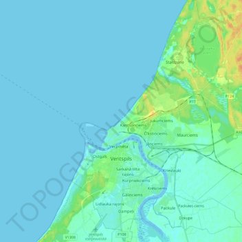
Name: Ventspils topographic map, elevation, terrain.
Location: Ventspils, Courland, Latvia (57.34799 21.51738 57.47058 21.67347)
Average elevation: 4 m
Minimum elevation: -2 m
Maximum elevation: 27 m
Other topographic maps
Click on a map to view its topography, its elevation and its terrain.