Geolocate

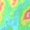
Banner Elk topographic map

Click on the map to display elevation.

Banner Elk

Banner Elk is nestled within the Blue Ridge Mountains, characterized by rugged and varied terrain. The town itself sits at an elevation of around 3,700 feet, offering expansive views of the surrounding peaks and valleys. This region, part of the southern Appalachian range, includes steep slopes, dense forests, and high mountain peaks that reach over 5,000 feet in places like Grandfather Mountain nearby. The diverse topography contributes to a cooler-than-typical southern climate, with Banner Elk’s terrain impacting local weather patterns and creating a unique mountain microclimate that often brings snow in winter and cooler, pleasant temperatures in summer. This mountainous terrain is both scenic and functional, supporting outdoor activities such as hiking and skiing, which have become central to Banner Elk’s local culture and tourism.

About this map
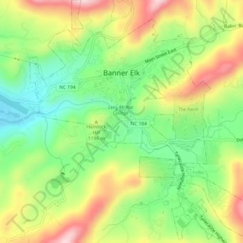
Name: Banner Elk topographic map, elevation, terrain.

Location: Banner Elk, Avery County, North Carolina, 28604, United States (36.13897 -81.88774 36.17356 -81.84810)

Average elevation: 1,165 m

Minimum elevation: 1,036 m

Maximum elevation: 1,332 m

Other topographic maps

Click on a map to view its topography, its elevation and its terrain.
Flat Springs

United States > North Carolina > Avery County

Average elevation: 1,017 m

Pineola

United States > North Carolina > Avery County

Average elevation: 1,107 m

Linville

United States > North Carolina > Avery County

Average elevation: 1,184 m

Cranberry

United States > North Carolina > Avery County

Average elevation: 1,088 m

Linville

United States > North Carolina > Avery County

Average elevation: 1,184 m

Linville

United States > North Carolina > Avery County

Average elevation: 1,184 m

Linville

United States > North Carolina > Avery County

Average elevation: 1,184 m

Valley

United States > North Carolina > Avery County

Average elevation: 1,265 m

Pineola

United States > North Carolina > Avery County

Average elevation: 1,107 m

Beech Mountain

United States > North Carolina > Avery County > Beech Mountain

Beech Mountain is a mountain in the North Carolina High Country and wholly in the Pisgah National Forest. Its elevation reaches 5,506 feet (1,657 m) and generates feeder streams for the Elk River. Nestled on the top is the Town of Beech Mountain.

Average elevation: 1,433 m
Plumtree

United States > North Carolina > Avery County

Average elevation: 1,008 m

Linville

United States > North Carolina > Avery County

Average elevation: 1,184 m

Gear up for your next adventure:

🦯Adjustable Trekking Poles - Reduce impact on knees when descending steep topographic ridges
👕UPF 50+ Sun Shirts - Essential protection against the harsh Australian sun during field work
📱Shockproof Phone Cases - Extra protection for your smartphone against drops on rocky terrain
🍴Titanium Spork & Cutlery - Indestructible and feather-light eating utensils
⛺Ultralight Solo Tents - Compact shelters for multi-day topographic surveying expeditions

As an Amazon Associate, this site earns from qualifying purchases at no extra cost to you.