
River topographic map
Interactive map
Click on the map to display elevation.
About this map
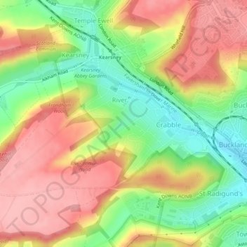
Name: River topographic map, elevation, terrain.
Location: River, Douvres, Kent, Angleterre, Royaume-Uni (51.13301 1.25211 51.14895 1.28951)
Average elevation: 80 m
Minimum elevation: 15 m
Maximum elevation: 136 m
Other topographic maps
Click on a map to view its topography, its elevation and its terrain.
Dover
Royaume-Uni > Angleterre > Kent > Douvres
Dover, Douvres, Kent, South East England, Angleterre, Royaume-Uni
Average elevation: 57 m