Geolocate

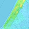
Numansdorp topographic map

Click on the map to display elevation.

About this map

Name: Numansdorp topographic map, elevation, terrain.

Location: Numansdorp, Hoeksche Waard, South Holland, Netherlands (51.69247 4.37270 51.76531 4.53502)

Average elevation: 0 m

Minimum elevation: -5 m

Maximum elevation: 20 m

Other topographic maps

Click on a map to view its topography, its elevation and its terrain.

Tweede Tol

Netherlands > South Holland > Dordrecht

Average elevation: 0 m

Gooland

Netherlands > South Holland > Nootdorp

Average elevation: -2 m

Langeraar

Netherlands > South Holland

Average elevation: -3 m

Waalhaven

Netherlands > South Holland > Rotterdam

Average elevation: 3 m

Meijendel

Netherlands > South Holland > Wassenaar

Average elevation: 6 m

Botlek

Netherlands > South Holland

Average elevation: 3 m

Meije

Netherlands > South Holland > Nieuwkoop

Average elevation: -2 m

Ankerpark

Netherlands > South Holland > Leiden

Average elevation: 3 m

Weerestein

Netherlands > South Holland > Hillegom

Average elevation: 0 m

Weerestein

Netherlands > South Holland > Hillegom

Average elevation: 0 m

Coepelduynen

Netherlands > South Holland > Katwijk

Average elevation: 4 m

Middelsluis

Netherlands > South Holland > Numansdorp

Average elevation: 0 m

Broekhuizen

Netherlands > South Holland > Gouda

Average elevation: -1 m

Het Park

Netherlands > South Holland > Rotterdam

Average elevation: 4 m

Gear up for your next adventure:

👕UPF 50+ Sun Shirts - Essential protection against the harsh Australian sun during field work
🍳Camping Cookware - Cookware sets for outdoor meals
🏫Topographic World Globes - 3D physical relief globes to understand global geography
🩹Blister Prevention Tape - Apply to friction points before they become painful sores
🧢Wide Brim Sun Hats - Maximum coverage for the face and neck while out in the open

As an Amazon Associate, this site earns from qualifying purchases at no extra cost to you.