
Make a donation
Gear up for your next adventure:
As an Amazon Associate, this site earns from qualifying purchases at no extra cost to you.
Wenatchee topographic map
Click on the map to display elevation.
Make a donation
Gear up for your next adventure:
As an Amazon Associate, this site earns from qualifying purchases at no extra cost to you.
About this map
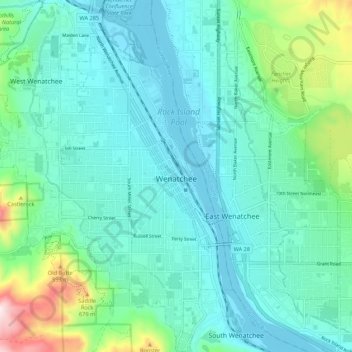
Name: Wenatchee topographic map, elevation, terrain.
Location: Wenatchee, Chelan County, Washington, 98801, United States (47.38749 -120.36772 47.46056 -120.29281)
Average elevation: 302 m
Minimum elevation: 184 m
Maximum elevation: 807 m
Make a donation
Gear up for your next adventure:
As an Amazon Associate, this site earns from qualifying purchases at no extra cost to you.
Other topographic maps
Click on a map to view its topography, its elevation and its terrain.
Mount David
United States > Washington > Chelan County
Mount David is a prominent 7,420-foot (2,260-metre) mountain summit located in Chelan County of Washington state. The mountain is situated in the Glacier Peak Wilderness, on land managed by the Okanogan-Wenatchee National Forest. Mount David is the highest point of Wenatchee Ridge, a subrange which also…
Average elevation: 1,736 m