Geolocate

Chloride topographic map

Click on the map to display elevation.

About this map

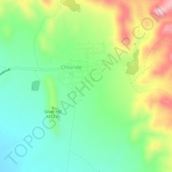
Name: Chloride topographic map, elevation, terrain.

Location: Chloride, Mohave County, Arizona, 86431, United States (35.39625 -114.20911 35.42604 -114.18524)

Average elevation: 1,245 m

Minimum elevation: 1,153 m

Maximum elevation: 1,405 m

Gear up for your next adventure:

🏕️Camping Gear - Essential camping equipment
🧥Packable Rain Jackets - Breathable waterproof layers for unpredictable mountain weather
🆘Personal Locator Beacons (PLB) - Satellite emergency beacons for life-saving help in areas with no mobile coverage
🥾Hiking Gaiters - Leg protection for trails
🧥Insulated Down Jackets - High warmth-to-weight ratio for cold nights in the high country

As an Amazon Associate, this site earns from qualifying purchases at no extra cost to you.