
Bourg de Magné topographic map
Interactive map
Click on the map to display elevation.
About this map
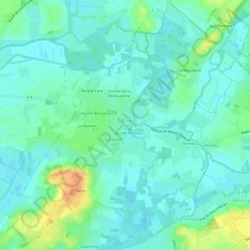
Name: Bourg de Magné topographic map, elevation, terrain.
Average elevation: 10 m
Minimum elevation: 0 m
Maximum elevation: 39 m
Other topographic maps
Click on a map to view its topography, its elevation and its terrain.
Sevreau
France > Nouvelle-Aquitaine > Deux-Sèvres > Magné
Sevreau, Magné, Niort, Deux-Sèvres, Nouvelle-Aquitaine, France métropolitaine, 79460, France
Average elevation: 11 m