Geolocate

Barons topographic map

Click on the map to display elevation.

About this map

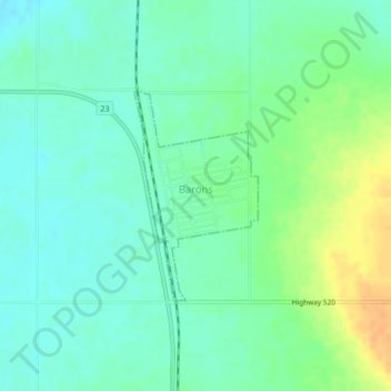
Name: Barons topographic map, elevation, terrain.

Location: Barons, Division No. 2, Alberta, Canada (49.98982 -113.08813 50.00423 -113.07483)

Average elevation: 965 m

Minimum elevation: 953 m

Maximum elevation: 987 m

Gear up for your next adventure:

🪫Rechargeable Headlamps - USB rechargeable headlamps
🛰️Handheld GPS Units - Rugged GPS devices for tracking coordinates and elevation in the Australian bush
👣Snake & Scrub Gaiters - Protection against spinifex, mud, and snakes while walking off-track
📚Map Reading & Navigation Guides - Master the art of interpreting topographic contours and symbols
🪢550 Survival Paracord - Versatile cordage for gear repair and emergency lashing

As an Amazon Associate, this site earns from qualifying purchases at no extra cost to you.