
Mosteiro topographic map
Interactive map
Click on the map to display elevation.
About this map
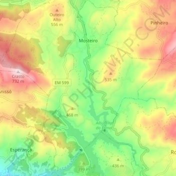
Name: Mosteiro topographic map, elevation, terrain.
Location: Mosteiro, Vieira do Minho, Braga, Portugal (41.57744 -8.15470 41.63239 -8.10428)
Average elevation: 436 m
Minimum elevation: 203 m
Maximum elevation: 721 m