
晋中市 topographic map
Interactive map
Click on the map to display elevation.
About this map
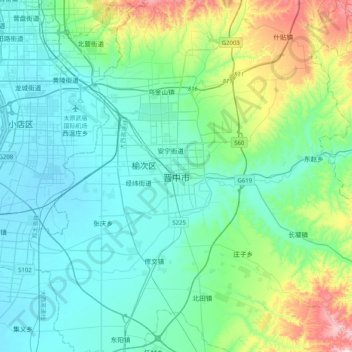
Name: 晋中市 topographic map, elevation, terrain.
Location: 晋中市, 榆次区 (Yuci), 晋中市, Shanxi, China (37.52668 112.57834 37.84668 112.89834)
Average elevation: 883 m
Minimum elevation: 767 m
Maximum elevation: 1,386 m