Geolocate

Hockley topographic map

Click on the map to display elevation.

About this map

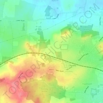
Name: Hockley topographic map, elevation, terrain.

Location: Hockley, Rochford, Essex, England, United Kingdom (51.59337 0.61706 51.62138 0.66980)

Average elevation: 35 m

Minimum elevation: 2 m

Maximum elevation: 81 m

Gear up for your next adventure:

🍶Collapsible Water Bottles - Save space in your pack as you consume your water supply
🎒40L Day Hiking Backpacks - Comfortable packs with hydration support for long days exploring topographic peaks
🖼️Scratch-off Australia Map - Track the regions and peaks you have explored geographically
🚗Car Camping Gear - Equipment for vehicle camping
🧤Hiking Gloves - Protective gloves for outdoor use

As an Amazon Associate, this site earns from qualifying purchases at no extra cost to you.