
Thank you for supporting this site ❤️
Make a donation
Make a donation
Gear up for your next adventure:
As an Amazon Associate, this site earns from qualifying purchases at no extra cost to you.
Dalash topographic map
Click on the map to display elevation.
Thank you for supporting this site ❤️
Make a donation
Make a donation
Gear up for your next adventure:
As an Amazon Associate, this site earns from qualifying purchases at no extra cost to you.
About this map
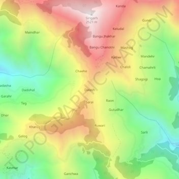
Name: Dalash topographic map, elevation, terrain.
Location: Dalash, Ani, Kullu, Himachal Pradesh, 172025, India (31.36713 77.41417 31.40713 77.45417)
Average elevation: 1,802 m
Minimum elevation: 1,183 m
Maximum elevation: 2,497 m
Thank you for supporting this site ❤️
Make a donation
Make a donation
Gear up for your next adventure:
As an Amazon Associate, this site earns from qualifying purchases at no extra cost to you.