
Karstel topographic map
Interactive map
Click on the map to display elevation.
About this map
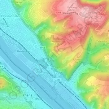
Name: Karstel topographic map, elevation, terrain.
Average elevation: 139 m
Minimum elevation: 65 m
Maximum elevation: 271 m
Other topographic maps
Click on a map to view its topography, its elevation and its terrain.
Höhr
Deutschland > Rheinland-Pfalz > Rhein-Lahn-Kreis > Lahnstein
Höhr, Lahnstein, Rhein-Lahn-Kreis, Rheinland-Pfalz, 56133, Deutschland
Average elevation: 252 m