
Stafford County topographic map
Interactive map
Click on the map to display elevation.
About this map
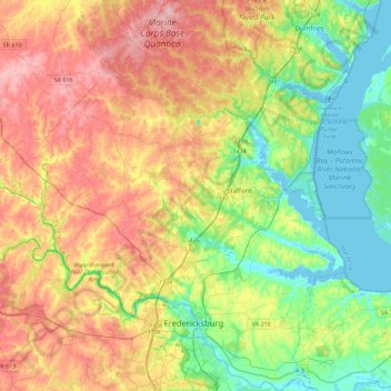
Name: Stafford County topographic map, elevation, terrain.
Location: Stafford County, Virginia, United States (38.24212 -77.63416 38.59060 -77.28621)
Average elevation: 61 m
Minimum elevation: -5 m
Maximum elevation: 143 m