Geolocate

Pleasant Ridge topographic map

Click on the map to display elevation.

About this map
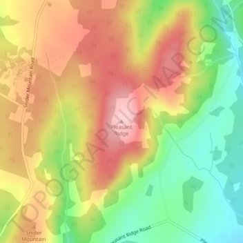
Name: Pleasant Ridge topographic map, elevation, terrain.

Location: Pleasant Ridge, Studholm Parish, Kings County, New Brunswick, E5P 4B4, Canada (45.82673 -65.62081 45.82683 -65.62071)

Average elevation: 157 m

Minimum elevation: 54 m

Maximum elevation: 252 m

Other topographic maps

Click on a map to view its topography, its elevation and its terrain.

Town of Sussex

Canada > New Brunswick > Kings County

Average elevation: 60 m

Havelock Parish

Canada > New Brunswick > Kings County

Average elevation: 90 m

Town of Rothesay

Canada > New Brunswick > Kings County

Average elevation: 51 m

Town of Hampton

Canada > New Brunswick > Kings County

Average elevation: 88 m

Town of Rothesay

Canada > New Brunswick > Kings County

Average elevation: 54 m

Town of Sussex

Canada > New Brunswick > Kings County

Average elevation: 59 m

Gear up for your next adventure:

🎨Portable Watercolor Kits - Paint the landscapes and topographic views you discover
🚁Camera Drones with GPS - Capture aerial views of the landscape to compare with topo maps
🔪Outdoor Multi-tools - Versatile tools for gear repair and survival tasks in the wilderness
🆘Personal Locator Beacons (PLB) - Satellite emergency beacons for life-saving help in areas with no mobile coverage
🛰️Handheld GPS Units - Rugged GPS devices for tracking coordinates and elevation in the Australian bush

As an Amazon Associate, this site earns from qualifying purchases at no extra cost to you.