Geolocate

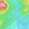
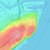
Les Rivières topographic map

Click on the map to display elevation.

About this map

Name: Les Rivières topographic map, elevation, terrain.

Location: Les Rivières, Quebec, Urban agglomeration of Québec, Capitale-Nationale, Quebec, Canada (46.78926 -71.36401 46.87015 -71.23917)

Average elevation: 53 m

Minimum elevation: 0 m

Maximum elevation: 171 m

Other topographic maps

Click on a map to view its topography, its elevation and its terrain.
Gear up for your next adventure:

🧦Hiking Socks - Comfortable socks for long hikes
⌛Survival Blankets - Emergency thermal blankets
🧭Global Orienteering Compass - High-precision liquid-filled compasses for accurate map reading and navigation
🐍Snake Gaiters - Protection against snake bites
🪫Rechargeable Headlamps - USB rechargeable headlamps

As an Amazon Associate, this site earns from qualifying purchases at no extra cost to you.