Geolocate

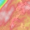
Wawayanda topographic map

Click on the map to display elevation.

About this map

Name: Wawayanda topographic map, elevation, terrain.

Location: Wawayanda, Vernon Township, Sussex County, New Jersey, 07422, United States (41.16955 -74.44723 41.20955 -74.40723)

Average elevation: 370 m

Minimum elevation: 234 m

Maximum elevation: 437 m

Other topographic maps

Click on a map to view its topography, its elevation and its terrain.

Gear up for your next adventure:

🥶Thermal Beanies - Warm hats for cold hikes
⌚GPS Watches - GPS watches for outdoor sports
⌚Altimeter Barometer Watches - Outdoor watches with built-in sensors to track altitude changes and weather shifts
🥤Outdoor Water Bottles - Reusable bottles for outdoor activities
🔌Fast Charging Adapters - Quickly top up all your gear before heading back into the field

As an Amazon Associate, this site earns from qualifying purchases at no extra cost to you.