Geolocate

Manson topographic map

Click on the map to display elevation.

About this map
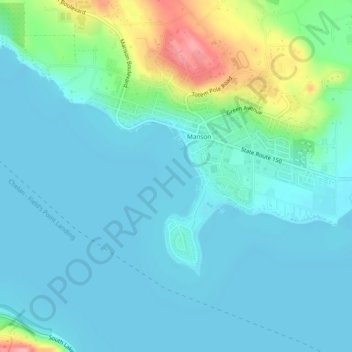
Name: Manson topographic map, elevation, terrain.

Location: Manson, Chelan County, Washington, United States (47.86652 -120.18717 47.89611 -120.13986)

Average elevation: 353 m

Minimum elevation: 331 m

Maximum elevation: 447 m

Gear up for your next adventure:

👕UPF 50+ Sun Shirts - Essential protection against the harsh Australian sun during field work
🧢Wide Brim Sun Hats - Maximum coverage for the face and neck while out in the open
🔋Solar Power Banks - Solar chargers for outdoors
🔥Camping Stoves - Portable stoves for outdoor cooking
📡Portable Emergency Radios - Stay informed about weather warnings and bushfire alerts

As an Amazon Associate, this site earns from qualifying purchases at no extra cost to you.