
Xhéneumont topographic map
Interactive map
Click on the map to display elevation.
About this map
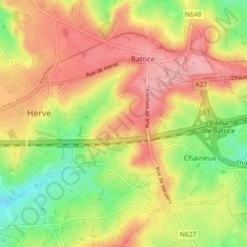
Name: Xhéneumont topographic map, elevation, terrain.
Location: Xhéneumont, Herve, Verviers, Liège, Wallonie, 4650, Belgique (50.61744 5.79474 50.65744 5.83474)
Average elevation: 283 m
Minimum elevation: 222 m
Maximum elevation: 335 m
Other topographic maps
Click on a map to view its topography, its elevation and its terrain.
Château de Bolland
Belgique > Liège > Verviers > Herve
Château de Bolland, Chemin église, Bolland, Herve, Verviers, Liège, Wallonie, 4653, Belgique
Average elevation: 245 m
Xhendelesse
Belgique > Liège > Verviers > Herve
Xhendelesse, Herve, Verviers, Liège, Wallonie, 4650, Belgique
Average elevation: 242 m