Geolocate

Pino topographic map

Click on the map to display elevation.

Pino

La commune est traversée par la route D 80 appelée localement « grande corniche ». Dans sa partie sud, elle a été tracée à une altitude moyenne de (130 m), dépassant 140 m au village de Pino qu'elle dessert. Elle redescend ensuite jusqu'à 47 m dans sa partie nord sans jamais frôler la côte. Elle a été construite vers 1876, soit quelques années après la « petite corniche ».

About this map
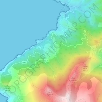
Name: Pino topographic map, elevation, terrain.

Location: Pino, Bastia, Haute-Corse, Corse, France métropolitaine, 20228, France (42.88807 9.33180 42.92807 9.37180)

Average elevation: 243 m

Minimum elevation: 0 m

Maximum elevation: 819 m

Gear up for your next adventure:

🧺Waterproof Dry Sacks - Organize your pack and keep electronics safe from rain and river crossings
🎽Hiking Clothing - Breathable clothing for hiking
🦟Insect Repellent - Protection against insects
🔭Compact Hiking Binoculars - Lightweight optics for scouting routes or birdwatching
🥤Outdoor Water Bottles - Reusable bottles for outdoor activities

As an Amazon Associate, this site earns from qualifying purchases at no extra cost to you.