Geolocate

Couch topographic map

Click on the map to display elevation.

About this map

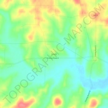
Name: Couch topographic map, elevation, terrain.

Location: Couch, Oregon County, Missouri, United States (36.58617 -91.40319 36.62617 -91.36319)

Average elevation: 202 m

Minimum elevation: 173 m

Maximum elevation: 245 m

Gear up for your next adventure:

🪢550 Survival Paracord - Versatile cordage for gear repair and emergency lashing
🎽Hiking Clothing - Breathable clothing for hiking
🔑Heavy Duty Carabiners - Secure gear to the outside of your pack for easy access
🎽Base Layers - Thermal base layers
🧥Thermal Emergency Blankets - Compact Mylar blankets to prevent hypothermia if stranded overnight

As an Amazon Associate, this site earns from qualifying purchases at no extra cost to you.