Geolocate

Valemount topographic map

Click on the map to display elevation.

About this map

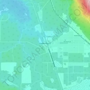
Name: Valemount topographic map, elevation, terrain.

Location: Valemount, Regional District of Fraser-Fort George, British Columbia, V0E 2Z0, Canada (52.81522 -119.28227 52.84654 -119.24649)

Average elevation: 795 m

Minimum elevation: 763 m

Maximum elevation: 959 m

Other topographic maps

Click on a map to view its topography, its elevation and its terrain.

Gear up for your next adventure:

🚗Car Camping Gear - Equipment for vehicle camping
👄SPF Lip Balm - Prevent sun and wind-burnt lips on mountain ridges
🛌Compact Down Sleeping Bags - Warmth without the bulk, ideal for backcountry camping
🌧️Rain Jackets - Waterproof jackets for hiking
🔋Solar Power Banks - Charge your phone and GPS using the sun while deep in the bush

As an Amazon Associate, this site earns from qualifying purchases at no extra cost to you.