
Eisfeld topographic map
Interactive map
Click on the map to display elevation.
About this map
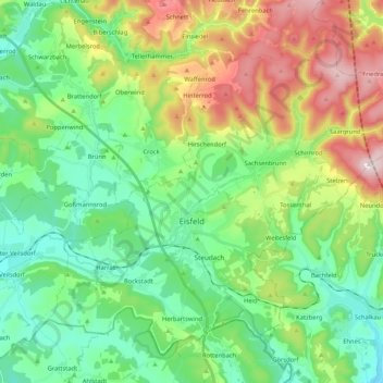
Name: Eisfeld topographic map, elevation, terrain.
Location: Eisfeld, Landkreis Hildburghausen, Thuringia, Germany (50.38017 10.83047 50.49426 11.04007)
Average elevation: 525 m
Minimum elevation: 364 m
Maximum elevation: 867 m