Geolocate

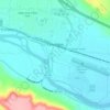
Nye topographic map

Click on the map to display elevation.

About this map

Name: Nye topographic map, elevation, terrain.

Location: Nye, Stillwater County, Montana, United States (45.41502 -109.82365 45.45502 -109.78365)

Average elevation: 1,535 m

Minimum elevation: 1,441 m

Maximum elevation: 1,865 m

Other topographic maps

Click on a map to view its topography, its elevation and its terrain.
Columbus

United States > Montana > Stillwater County

Average elevation: 1,107 m

Mystic Lake

United States > Montana > Stillwater County

Average elevation: 2,641 m

Princess Lake

United States > Montana > Stillwater County

Average elevation: 3,010 m

Park City

United States > Montana > Stillwater County > Park City

Average elevation: 1,049 m

Gear up for your next adventure:

🧥Down Jackets - Insulated jackets for cold weather
📡Weather Radios - Emergency weather radios
👟Lightweight Trail Runners - Agile footwear for fast movement over rugged Australian terrain
🔑Heavy Duty Carabiners - Secure gear to the outside of your pack for easy access
📱Tablet Tripod Mounts - Steady platforms for viewing digital maps or taking long exposures

As an Amazon Associate, this site earns from qualifying purchases at no extra cost to you.