
Thank you for supporting this site ❤️
Make a donation
Make a donation
Gear up for your next adventure:
As an Amazon Associate, this site earns from qualifying purchases at no extra cost to you.
Filabusi topographic map
Click on the map to display elevation.
Thank you for supporting this site ❤️
Make a donation
Make a donation
Gear up for your next adventure:
As an Amazon Associate, this site earns from qualifying purchases at no extra cost to you.
About this map
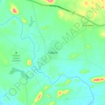
Name: Filabusi topographic map, elevation, terrain.
Location: Filabusi, Insiza, Matabeleland South Province, Zimbabwe (-20.57569 29.24480 -20.49569 29.32480)
Average elevation: 1,074 m
Minimum elevation: 1,026 m
Maximum elevation: 1,245 m
Thank you for supporting this site ❤️
Make a donation
Make a donation
Gear up for your next adventure:
As an Amazon Associate, this site earns from qualifying purchases at no extra cost to you.