
Kyenda topographic map
Interactive map
Click on the map to display elevation.
About this map
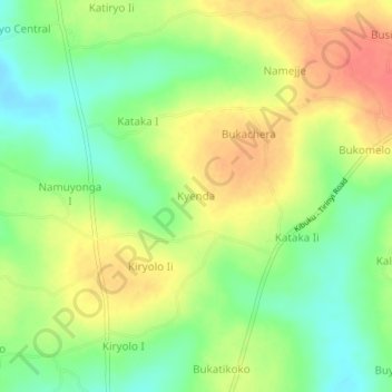
Name: Kyenda topographic map, elevation, terrain.
Location: Kyenda, Kibuku, Eastern Region, Uganda (1.01231 33.75116 1.05231 33.79116)
Average elevation: 1,080 m
Minimum elevation: 1,054 m
Maximum elevation: 1,107 m