
Soutelo topographic map
Interactive map
Click on the map to display elevation.
About this map
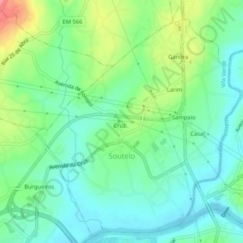
Name: Soutelo topographic map, elevation, terrain.
Location: Soutelo, Vila Verde, Braga, 4730-570, Portugal (41.60344 -8.45520 41.62916 -8.42485)
Average elevation: 48 m
Minimum elevation: 20 m
Maximum elevation: 112 m
Other topographic maps
Click on a map to view its topography, its elevation and its terrain.
Senhora do Alívio
Portugal > Braga > Vila Verde > Loureira
Senhora do Alívio, Loureira, Vila Verde, Braga, 4730-571, Portugal
Average elevation: 67 m