
Herbrechtingen topographic map
Interactive map
Click on the map to display elevation.
About this map
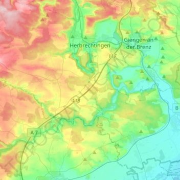
Name: Herbrechtingen topographic map, elevation, terrain.
Average elevation: 515 m
Minimum elevation: 439 m
Maximum elevation: 655 m
Other topographic maps
Click on a map to view its topography, its elevation and its terrain.
Kießental
Allemagne > Bade-Wurtemberg > Landkreis Heidenheim > Herbrechtingen
Kießental, Anhausen, Bolheim, Herbrechtingen, Landkreis Heidenheim, Bade-Wurtemberg, 89542, Allemagne
Average elevation: 549 m