Geolocate

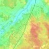
Hargshamn topographic map

Click on the map to display elevation.

About this map
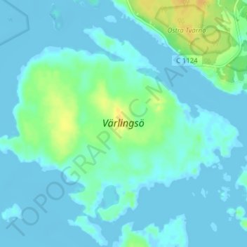
Name: Hargshamn topographic map, elevation, terrain.

Location: Hargshamn, Östhammars kommun, Uppsala County, Sweden, Värlingsö (60.17375 18.47808 60.19885 18.54122)

Average elevation: 5 m

Minimum elevation: -5 m

Maximum elevation: 23 m

Other topographic maps

Click on a map to view its topography, its elevation and its terrain.

Uppsala

Sweden > Uppsala County

Situated on the fertile Uppsala flatlands of muddy soil, the city features the small Fyris River (Fyrisån) flowing through the landscape surrounded by lush vegetation. Parallel to the river runs the glacial ridge of Uppsalaåsen at an elevation around 30 m (98 ft), the site of Uppsala's castle, from which…

Average elevation: 29 m

Brunnby

Sweden > Uppsala County > Knivsta

Average elevation: 29 m

Häggeby

Sweden > Uppsala County > Björklinge

Average elevation: 37 m

Västersjö

Sweden > Uppsala County

Average elevation: 22 m

Knivsta kommun

Sweden > Uppsala County

Average elevation: 25 m

Uppsala kommun

Sweden > Uppsala County

Average elevation: 36 m

Uppsala

Sweden > Uppsala County

Situated on the fertile Uppsala flatlands of muddy soil, the city features the small Fyris River (Fyrisån) flowing through the landscape surrounded by lush vegetation. Parallel to the river runs the glacial ridge of Uppsalaåsen at an elevation around 30 m (98 ft), the site of Uppsala's castle, from which…

Average elevation: 29 m

Ekeby Gård

Sweden > Uppsala County

Average elevation: 27 m

Bälinge

Sweden > Uppsala County

Average elevation: 28 m

Länna

Sweden > Uppsala County

Average elevation: 24 m

Skärplinge

Sweden > Uppsala County

Average elevation: 13 m

Österbyn

Sweden > Uppsala County

Average elevation: 6 m

Uppsala

Sweden > Uppsala County

Situated on the fertile Uppsala flatlands of muddy soil, the city features the small Fyris River (Fyrisån) flowing through the landscape surrounded by lush vegetation. Parallel to the river runs the glacial ridge of Uppsalaåsen at an elevation around 30 m (98 ft), the site of Uppsala's castle, from which…

Average elevation: 29 m

Storvreta

Sweden > Uppsala County

Average elevation: 34 m

Funbo

Sweden > Uppsala County

Average elevation: 19 m

Järlåsa

Sweden > Uppsala County

Average elevation: 60 m

Uppsala

Sweden > Uppsala County

Situated on the fertile Uppsala flatlands of muddy soil, the city features the small Fyris River (Fyrisån) flowing through the landscape surrounded by lush vegetation. Parallel to the river runs the glacial ridge of Uppsalaåsen at an elevation around 30 m (98 ft), the site of Uppsala's castle, from which…

Average elevation: 29 m

Enköpings kommun

Sweden > Uppsala County

Average elevation: 24 m

Östhammars kommun

Sweden > Uppsala County

Average elevation: 10 m

Älvkarleby kommun

Sweden > Uppsala County

Average elevation: 20 m

Älvkarleby

Sweden > Uppsala County

Average elevation: 19 m

Film

Sweden > Uppsala County

Average elevation: 30 m

Karbo

Sweden > Uppsala County

Average elevation: 41 m

Blackstalund

Sweden > Uppsala County

Average elevation: 45 m

Heby kommun

Sweden > Uppsala County

Average elevation: 61 m

Tuskö

Sweden > Uppsala County

Average elevation: 5 m

Hallkved

Sweden > Uppsala County > Funbo

Average elevation: 21 m

Källtorp

Sweden > Uppsala County > Funbo

Average elevation: 21 m

Gear up for your next adventure:

🦯Trekking Poles - Walking poles for hiking stability
🍳Ultralight Camping Stoves - Boil water quickly for meals using minimal fuel
🧤Thermal Hiking Gloves - Keep your hands warm and functional during high-altitude winter treks
🥾Hiking Boots - Durable hiking boots for trails and rough terrain
🏫Topographic World Globes - 3D physical relief globes to understand global geography

As an Amazon Associate, this site earns from qualifying purchases at no extra cost to you.